


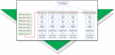
Regional mapping of key horizons
A regional exploration team at a large NOC needed to map key reservoir horizons across four producing oil fields, that while geographically adjacent to each other, were for a long period developed separately, where there was no exchange of knowledge between the separate Asset Teams.
Quickly convert legacy data to digital formats
A new entrant to a mature basin needed to gather surface and fault data from many images and scanned maps. Traditional digitising was slow, boring, and unpopular with the team, useful knowledge was being excluded because it was too difficult to capture.
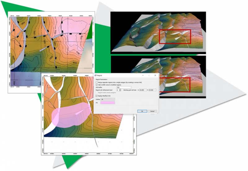
Improve geological accuracy of subsurface maps
Petrosys Exchange Case Study: Wellesley Petroleum was manually updating NPD cultural data in a Petrel reference project and needed a trusted solution capable of automating the process, ensuring frequent and timely access to accurate GIS data in Petrel to assist them with decision-making.
Capricorn Energy was mastering all prospect information in spreadsheets, however as their portfolio of prospects increased and balance of priorities evolved, they needed to improve efficiency in the assembly and analysis of prospects, so that investment portfolios could easily be prepared and reviewed on demand.
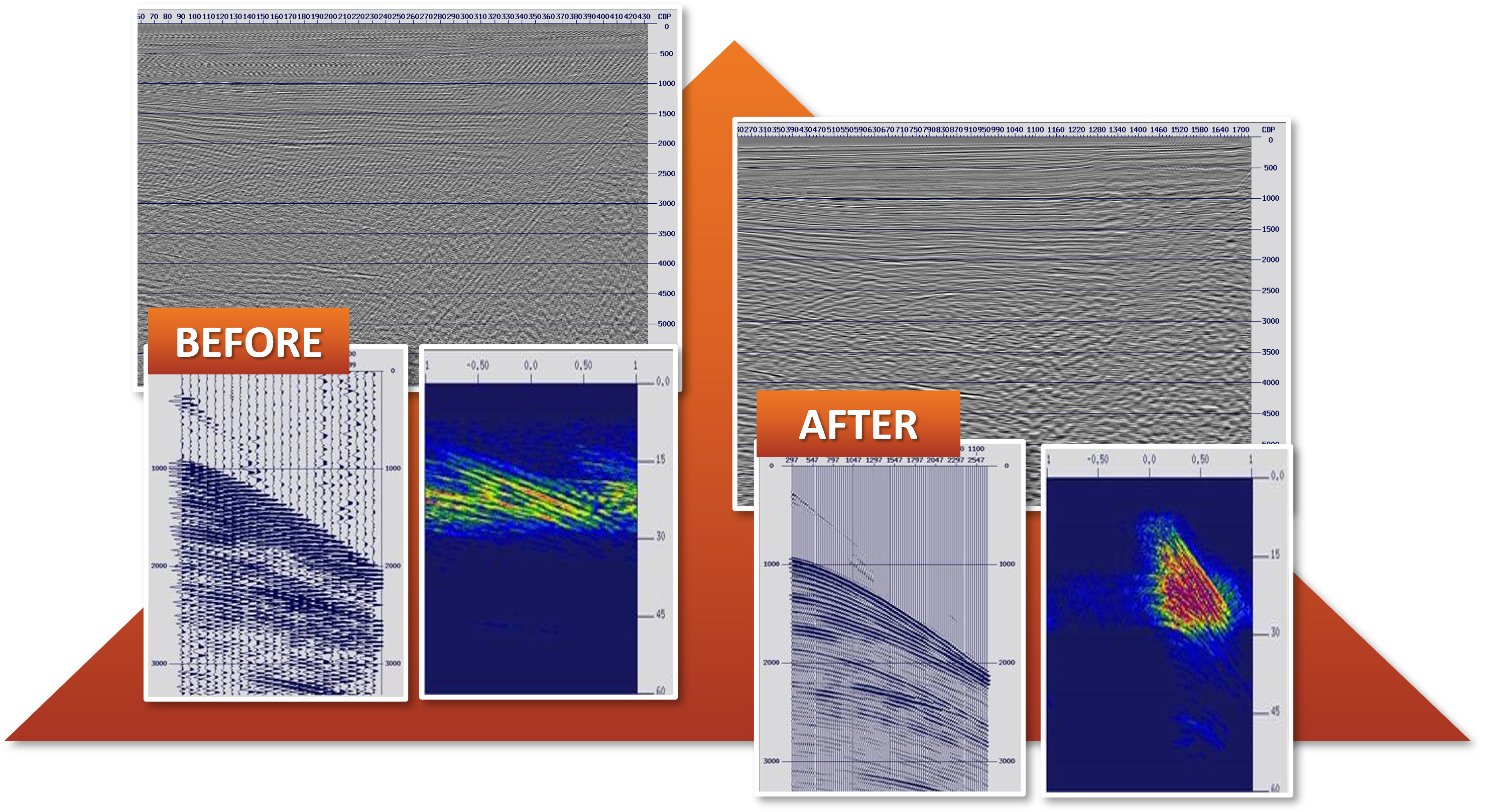
Improve spatial sampling of legacy datasets
There is a significant amount of vintage seismic data available, which if sensitively reprocessed could provide a lot of value. However, poor spatial sampling and therefore spatial aliasing of these vintage or legacy datasets remains a significant problem.
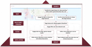
Identify, reconcile and move data with efficiency
An Australian based oil company found they needed to replace one of their major document repositories containing over 1.4 million files due to reliance on critical software that had become unsupported and to the decommissioning of Microsoft SharePoint 2010 software.
Linking Structured and Unstructured Data
Combining the power of Interica OneView™ and dbMap® provides the ability to catalogue both project data and unstructured files for quicker search and confident usage.