Petrosys PRO is the leader in mapping and surface modeling software solutions for the petroleum E&P industry. Delivering direct connectivity with the most popular exploration, production, and GIS data sources, Petrosys PRO produces high quality maps and surface models, it manages seismic, well, geoscience, and other specialised data used in the search for oil and gas.


Who Uses Petrosys PRO?

Everyone uses Petrosys PRO for its excellent data integration capabilities, & easy production of presentation quality maps and surfaces.

Geophysicists use Petrosys PRO’s fast and easy depth conversion.

Geologists use Petrosys PRO for probabilistic & deterministic volumetrics.

Explorationists use Petrosys PRO for its superior surface generation, particularly near faults, and flexible gridding algorithms.

Production geologists use Petrosys’ easily repeatable workflows to quickly integrate new data and update outputs.

Data managers use Petrosys PRO to exchange data between 3rd party applications and to integrate diverse data-sets.
“Maps are absolutely critical to the evaluation of complex subsurface features and, when constructed properly and thoughtfully, they can capture the essence of any prospect or opportunity. Petrosys PRO ticks all our boxes.”
Best Available Geoscience Mapping
Under pressure geoscientists need a faster and easier way to produce better quality maps
Petrosys PRO helps by:
- Easy production of clear and informative maps produced directly by geoscientists
- Unrivaled integration with other data sources
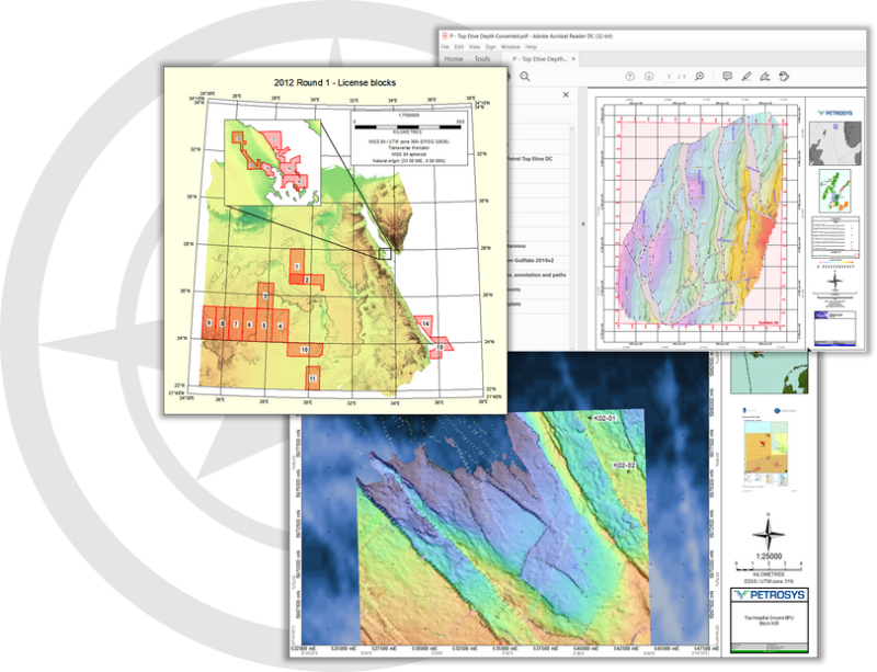
- Freely shareable outputs – layered PDFs, GeoTIFF, one-click export to Powerpoint, and many export formats.
“Petrosys PRO shortens project start-up time by around a third by greatly reducing the need for geotechs and data managers and letting the geoscientists screen and select relevant data for themselves.”
New Ventures & Data Screening
How can we quickly, and accurately, map all available data?
Petrosys PRO helps by:
- Reading live data from interpretation systems and GIS sources; reads flat files – Excel etc; imports legacy formats
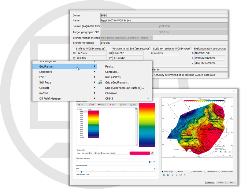
- Coordinate Reference Systems – dynamically converts data in different CRS – both re-projecting and datum transformation without needing a geomatics expert
- Quickly converts information from map images – convert images to grids and shapes, semi-automated digitising.
“Quickly identifying and refining prospects and potential volumes using Petrosys tools is critical to our workflows and gives us a competitive advantage.”
Exploration and Prospect Generation
How do we help our interpreters use their experience and get beyond “black box” modeling?
Petrosys PRO helps by:
- Advanced gridding algorithms suitable for particular jobs with all parameters transparent to/controllable by the user
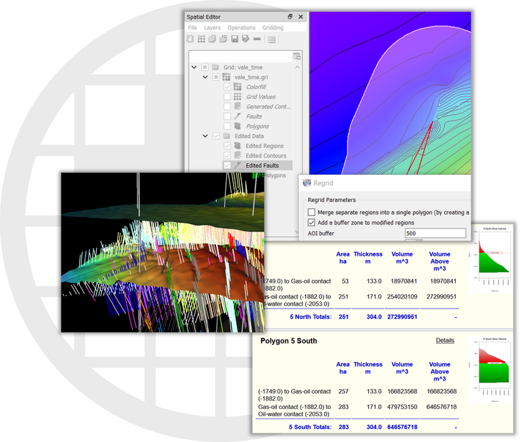
- Tools to create realistic fault polygons/surface intersections
- Intuitive and powerful surface, fault and shape editing
- Tools to automatically find prospects
- Quick, auditable and reliable deterministic volumetrics.
“The ease of integrating prospect and regional data and additional tools to assess prospect resources help our geoscientists and engineers to collaborate effectively.”
Appraisal
How do you test uncertainty with the increasing amount of data?
Petrosys PRO helps by:
- Integration of prospect and regional data-sets
- Cross-validation reports – test the influence of each well
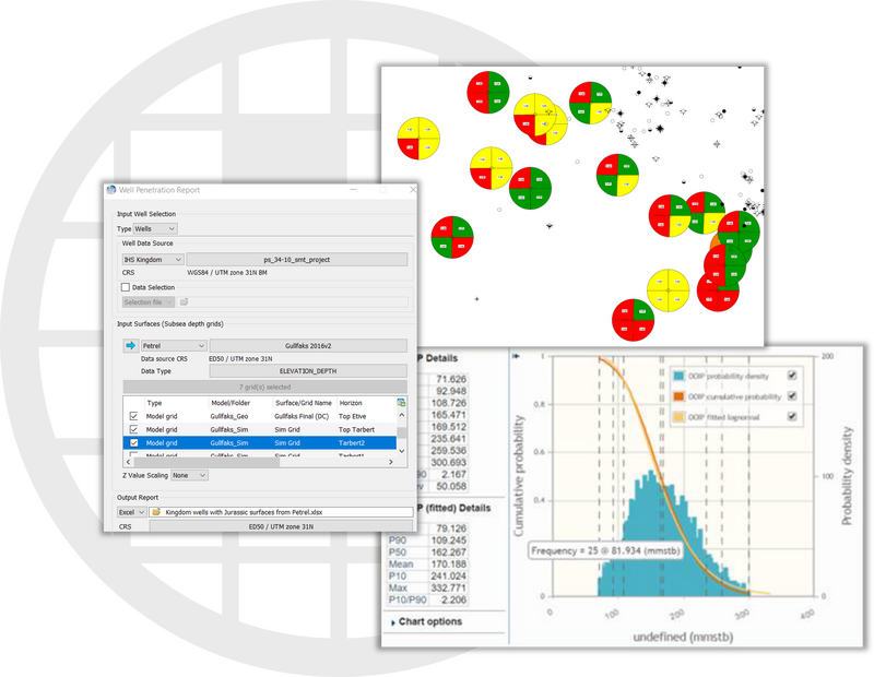
- Well penetration reports – combine surfaces from interpretation systems and GIS with Excel output
- Probabilistic volumetrics.
“The Petrosys task files are a massive time saver for us and let us confidently run frequent updates to our field models.”
Development & Production
How do we quickly update our field maps as new data arrives?
Petrosys PRO helps by:
- Workflow builder can update all aspects of a surface-based field model including depth conversion, volumetrics and even map generation
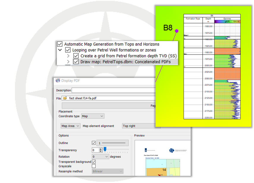
- Addition of log tracks with consistent corporate templates
- Easily display engineering data from Excel tables and PDFs.
Field maps are too busy and hard to interpret
Petrosys PRO helps by:
- Pie charts and bubble maps for production and key performance indicator “traffic light” displays
- The maps becomes the “source of truth” for reservoir engineers and geoscientists
- Over-post correction makes key labels clear
- Long term well and production data management is available in Petrosys dbMap product.