


Improve the Geological Accuracy of your Subsurface Maps
A new venture exploration team needed to map prospects in a highly faulted area. They knew the faults were present in their area of interest, but some were not being picked up by auto-tracking software – it became clear that to get what they wanted they would have to improve the geological accuracy of the subsurface maps. The exploration team ran Petrosys PRO to generate a subsurface grid based on a 3D seismic surface and fault sticks, then took advantage of the advanced grid editing tools to reinterpret a fault zone based on their specialist understanding of the area.
Many gridding operations provide a mathematical solution to a geological problem. We have ways of modeling trends and bias using geostatistical methods, yet the quality of a subsurface map is only as good as the input data.
Poor or incomplete datasets can lead to the creation of unrealistic surfaces, which can lead to poor economic decisions.
The Challenge
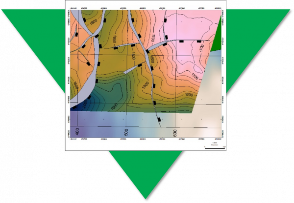
Due to missing input data, the resultant fault polygon has been terminated at its heave maxima. The adjacent contours highlight that this is unrealistic and the isolated fault should be extended to merge with the major N-S trending fault as a splay
The Solution
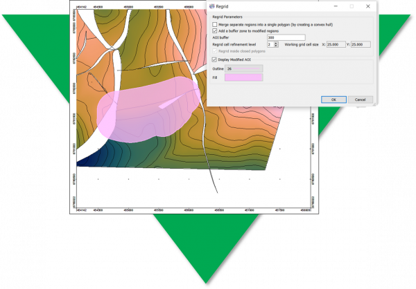
In Petrosys PRO, users have access to advance and easy-to-use grid editing tools, which allow them to edit the faults and contours embedded within a 3D surface. Any edits are then used to control a localised re-grid of the 3D structure and fault network.
The Result
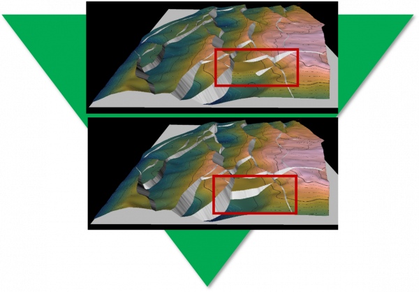
3D grid of the top reservoir showing the fault network before (top) and after (base) the geoscientist has reinterpreted the fault network
Geological Accuracy
The grid editing process allows the geoscientist to correct for geological inaccuracies and manipulate a surface where input data is missing. The tools provide a fast and effective way of generating a structurally-sound model, which has implications for hydrocarbon storage and compartmentalisation.
“I’ve just come out of an internal peer review and the reinterpretation of our maps have led to identification of two more prospects.”
Geoscientist, Oil Company”