

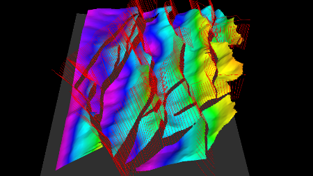
Using Fault Sticks To Generate Mapping Polygons
Petrosys users can automatically calculate fault polygons from fault sticks and horizon data – this is a major time saving over manual workflows. The output polygons can identify...
Petrosys users can automatically calculate fault polygons from fault sticks and horizon data – this is a major time saving over manual workflows. The output polygons can identify...
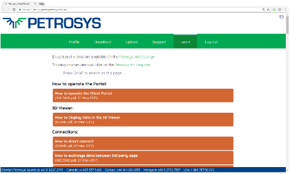
Committed to extending its globally recognized support services, oil and gas technology company Petrosys is excited to announce the launch of its Client Portal. The new online...

Subsurface Technology Day Thursday 11th May 2017 Novotel Perth Langley 221 Adelaide Terrace Perth WA 6000, Australia Join [...]

Welcome to MAPPING GURU, the newsletter that contains the latest news and information from Petrosys. Read Newsletter [...]
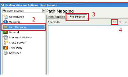
I have my data spread over a number of different folders and I was wondering if there is an easier way to search for the files for making my maps?
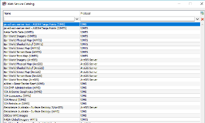
If you connect to web map services on a regular basis, it can be quite frustrating to have to look up the details each time you want to serve imagery from these services. However...
A key element in the decision-making process in the exploration and development of oil & gas fields is to have updated maps...
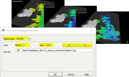
A little known, but very useful, feature of the 3D Viewer is the ability to create time lapse movies to watch an attribute change over time. There are many applications for this...