

If you connect to web map services on a regular basis, it can be quite frustrating to have to look up the details each time you want to serve imagery from these services. However, it is possible to catalogue the imagery for later use.
You can store web map services in a XML file called “uri_catalog.xml”. This file can be stored along the “pspath” hierarchy: first in the project directory, then in the local folder and finally under ps_misc of the relevant Petrosys version (more info in the online help under the topic PS_LOCAL CONFIGURATION DIRECTORY).
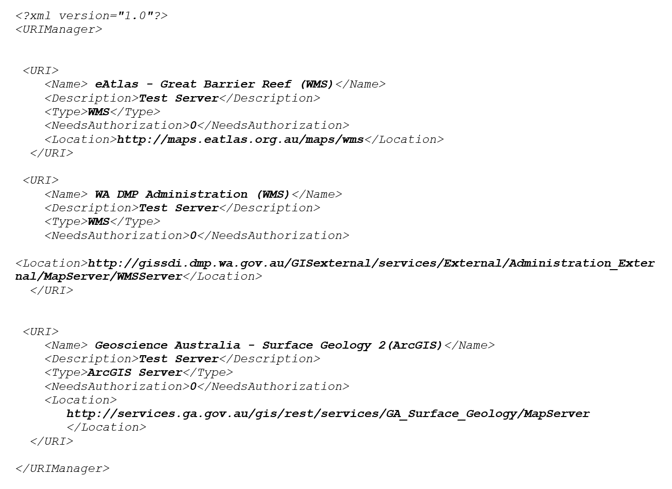
Once you have located the catalogue, open it with a text editor. It should look like the example below:
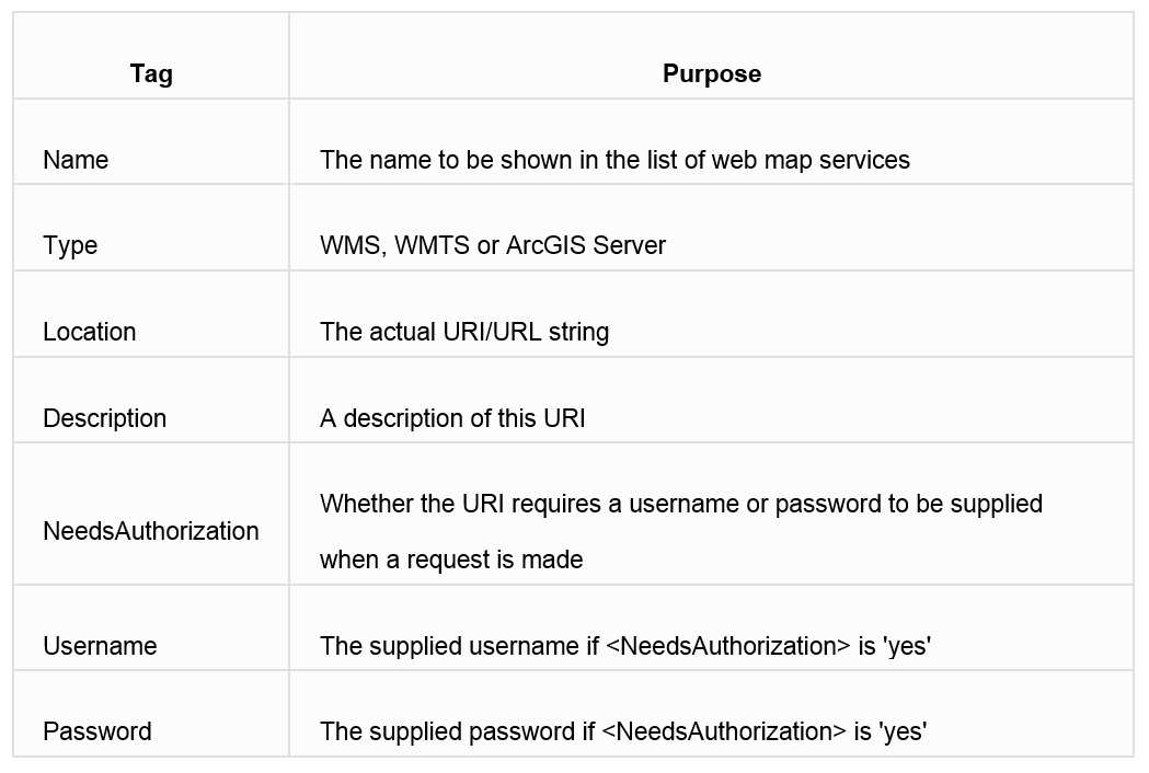
To add a new map service to the catalogue, an easy way is to copy/paste one of the existing entries and then replace details accordingly. To help you populate these parameters, see the table below from our online help.
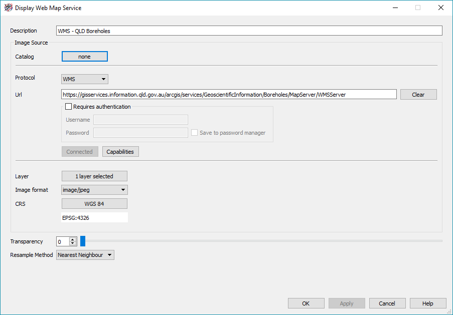
 After editing the new entry, save the file and launch Petrosys. Open your map and display a web map service from Display > Web Map Service… Click on the Catalog button.
 The Web Service Catalog will open, and the newly added service will now be available to be selected. Select and connect to it.
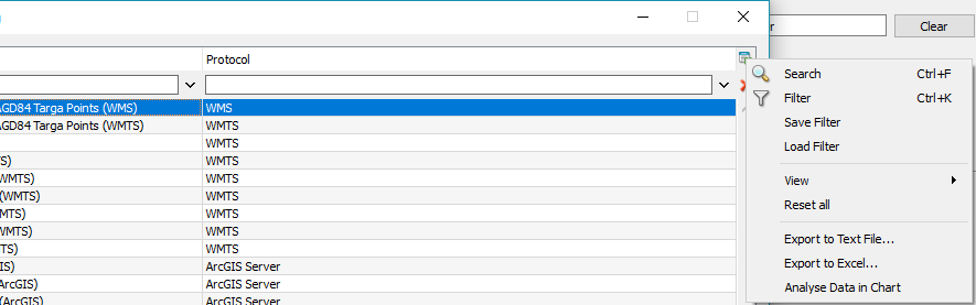
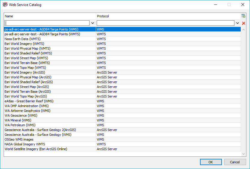 Tip: as in any other list in Petrosys, you can use the search/filter options to help locate the right service by name or protocol. This can be handy once your catalog gets large based on many stored services.
 Further information is available in the online help under the topic “RASTER IMAGES – WMS SERVER CATALOG”.