

Batch Mapping: one data set, multiple areas of interest
Petrosys PRO 2018.2 makes it possible to automatically create maps with the same input data over multiple areas of interest. This is done through a new option to loop over map extents.
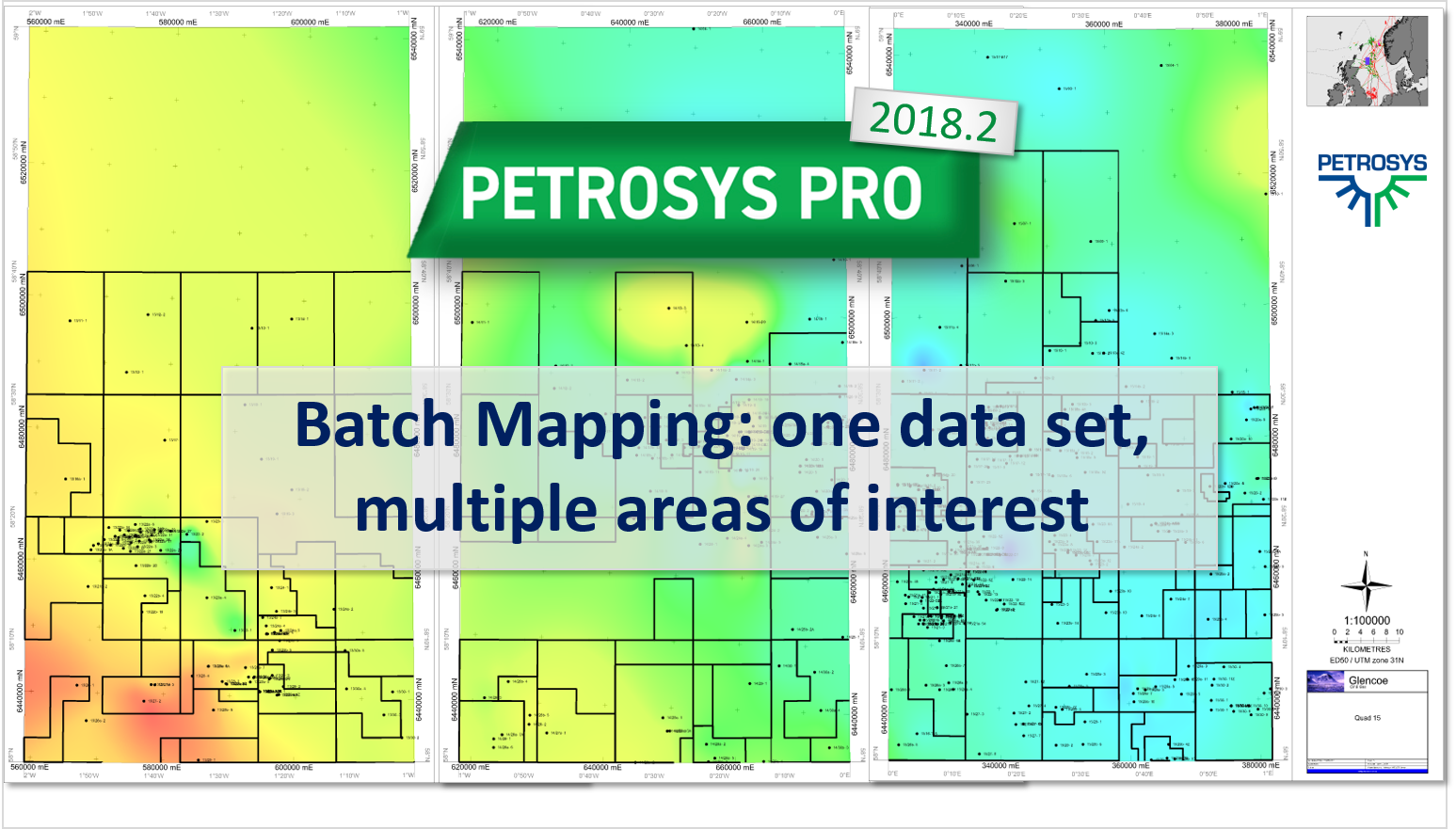
Petrosys PRO 2018.2 makes it possible to automatically create maps with the same input data over multiple areas of interest. This is done through a new option to loop over map extents.

Launch Petrosys PRO directly from DSG. New support for automatic Petrosys project creation, in combination with “drag & drop”, add seamless connectivity to user’s DSG session data for immediate access with.
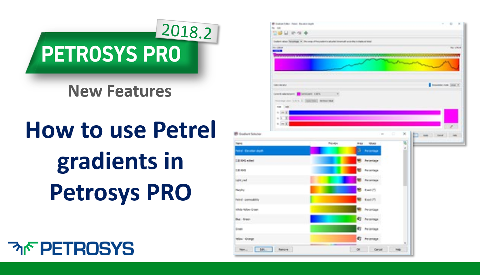
Petrosys PRO 2018.2, makes it easier to compare graphically colorfilled data with Petrel as we now support the display of Petrel gradients.
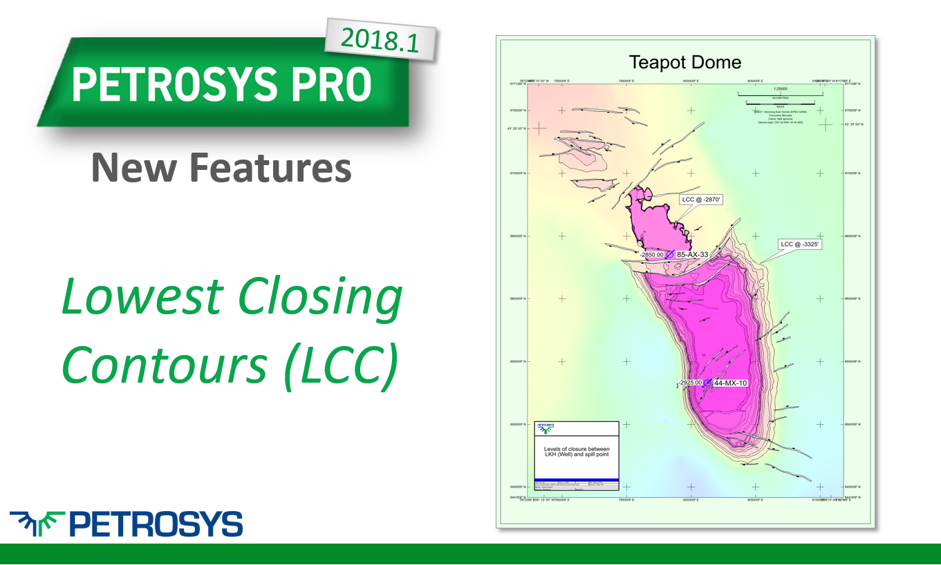
The Lowest Closing Contour (LCC) feature allows users to find prospects within their grid based on some simple user inputs. The LCC is designed to find the deepest closing contour within the grid.
Tape Ark's world first in oil & gas data management. Demonstrating how the cloud can be leveraged to perform manual tasks, previously taking months, in just minutes.

Now in Petrosys PRO 2018.1 it is much easier to setup a Petrosys project when launching our plugins from within Petrel and DecisionSpace.

Petrosys PRO 2018.1 New Features. WFS & ArcGIS web server support complements Petrosys PRO's existing WMS functionality to allow vector, raster & attribute data all to be sourced directly from web services.
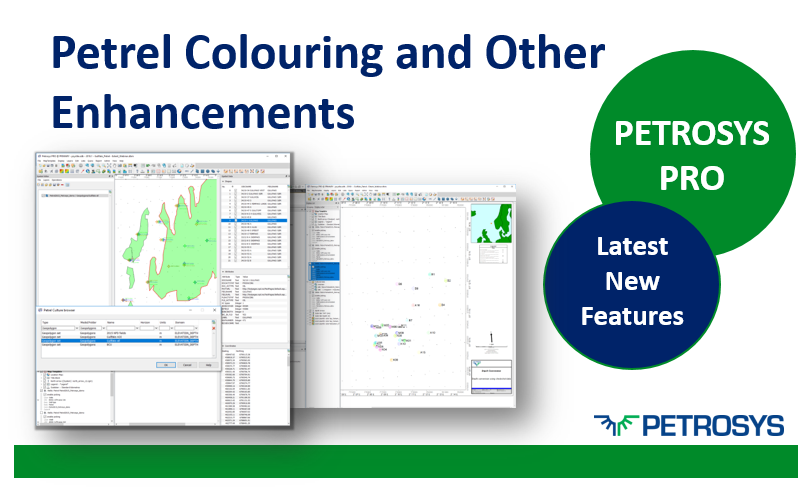
In Petrel, many users set colours for individual wells, for well folders and for well paths, this is now maintained in Petrosys PRO.