

The Petrosys PRO Project Crawler
The Petrosys PRO project crawler is a utility for extracting and collating summary information about large collections of Petrosys PRO files, such as all the grid files in a PRO project. The crawler can be set up to run automatically over a range of Petrosys PRO project directories on a regular basis.
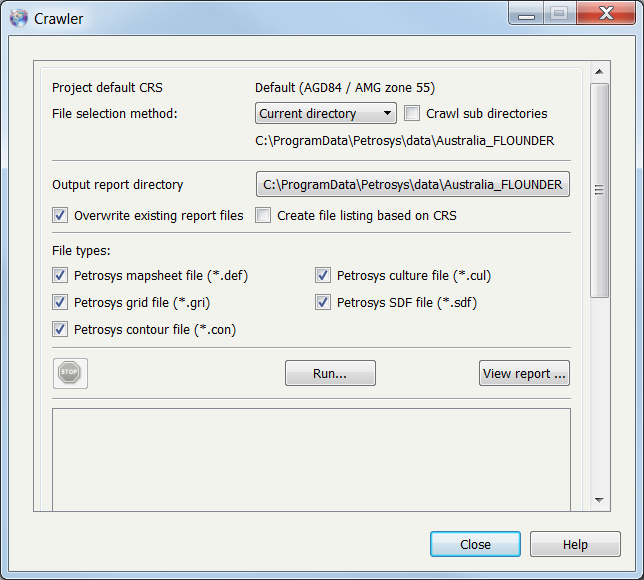
Above: The Petrosys PRO Project Crawler control panel. Found directly on the main PRO menu – TOOLS/Crawler
A run of the Petrosys PRO project crawler will examine all selected files (optionally including in project sub-directories) and produce a metadata summary in the form of a family of XML files, with one XML file per PRO file type crawled. A helpful report is created (‘View Report’ button) which summarises the result in an easy to review web page. Not all of the metadata in the XML files produced by the crawler is reported by the standard reports. It is possible to create customised stylesheets that will extract specific metadata content and formats that might be more suited to particular data management situations.
Learn more about how the Petrosys PRO Project Crawler works in harmony with Interica OneView.
The Petrosys PRO Grid AOI Crawler
The main Petrosys PRO window Tools menu has a little known, but useful, option called Grid AOI Crawler. This browses Petrosys PRO grids in a PRO project or site directory tree and returns the grid extents as a shapefile or file geodatabase. It also outputs a CSV file of the attribute data and a log file identifying any problematic grids.
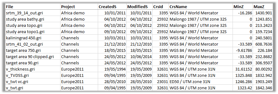
Output attributes include:
- Creator
- File path
- Grid name
- Petrosys PRO project
- Created and modified date as text or as sortable numbers
- ESPG code
- EPSG name
- Flag for whether grid has a valid Coordinate Reference System
- Minimum and maximum z-values
All these attributes can be reported on the map or used for thematic mapping and filtering in the Display/GIS option.
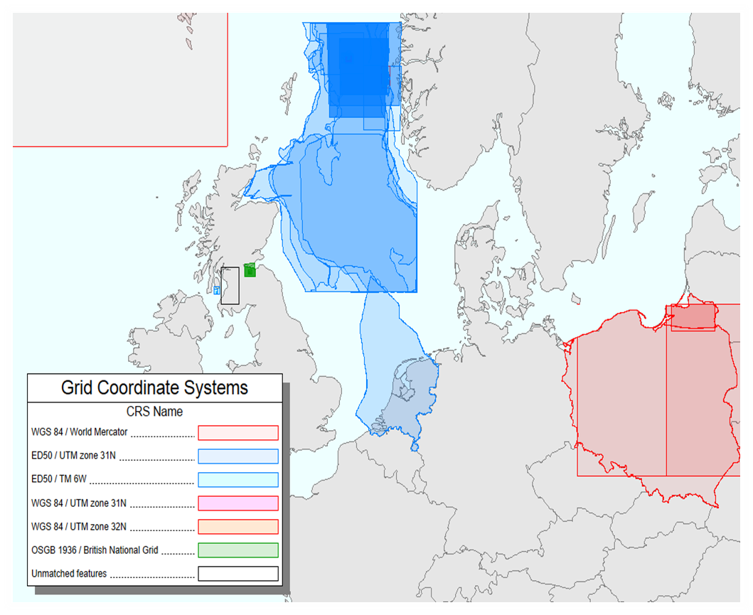
For geoscientists, this is a useful way to get away from “postage stamp” interpretation and start piecing together the jigsaw of regional interpretation projects. Geodesists can browse the coordinate systems being used within the company to ensure compliance with corporate standards, whilst data managers will find it an invaluable way to identify duplicate grids as well as old grids that may now be obsolete.