

We often edit and share data as Excel spreadsheets. How can I display this type of data on my map?
In the new release of Petrosys (V17.3), we have added support on Windows and Linux for Excel spreadsheets – both XLS and XLSX – and ASCII text files. It means this type of data – including point, line and polygon – can be directly displayed in Mapping or used as a data source in Surface Modeling. Additionally, you can exchange the data into various files, for example shapefiles, using the Petrosys Spatial Data Translator.
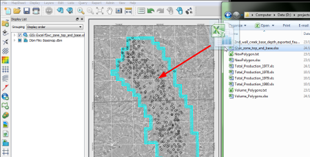
To display data from an Excel spreadsheet you use the Display/GIS option, choose Excel as your data source and then define the format of the data. Alternatively, you can simply drag and drop your Excel spreadsheet directly onto your map and Petrosys will automatically display the data. As simple as that!
If you need further details and assistance, please send an email to support@petrosys.com.au.