

I have point data in a Shape File and I would like to back interpolate grid values to a new attribute within my Shape File. How can I do this in Petrosys?
Data from a Petrosys grid file can be back interpolated to GIS data sources, such as Shape files, Excel files, File Geodatabases, Petrosys Culture Files and dbMap Culture, in both Surface Modeling and in Mapping’s Spatial Editor. Here’s how to do this in both modules…
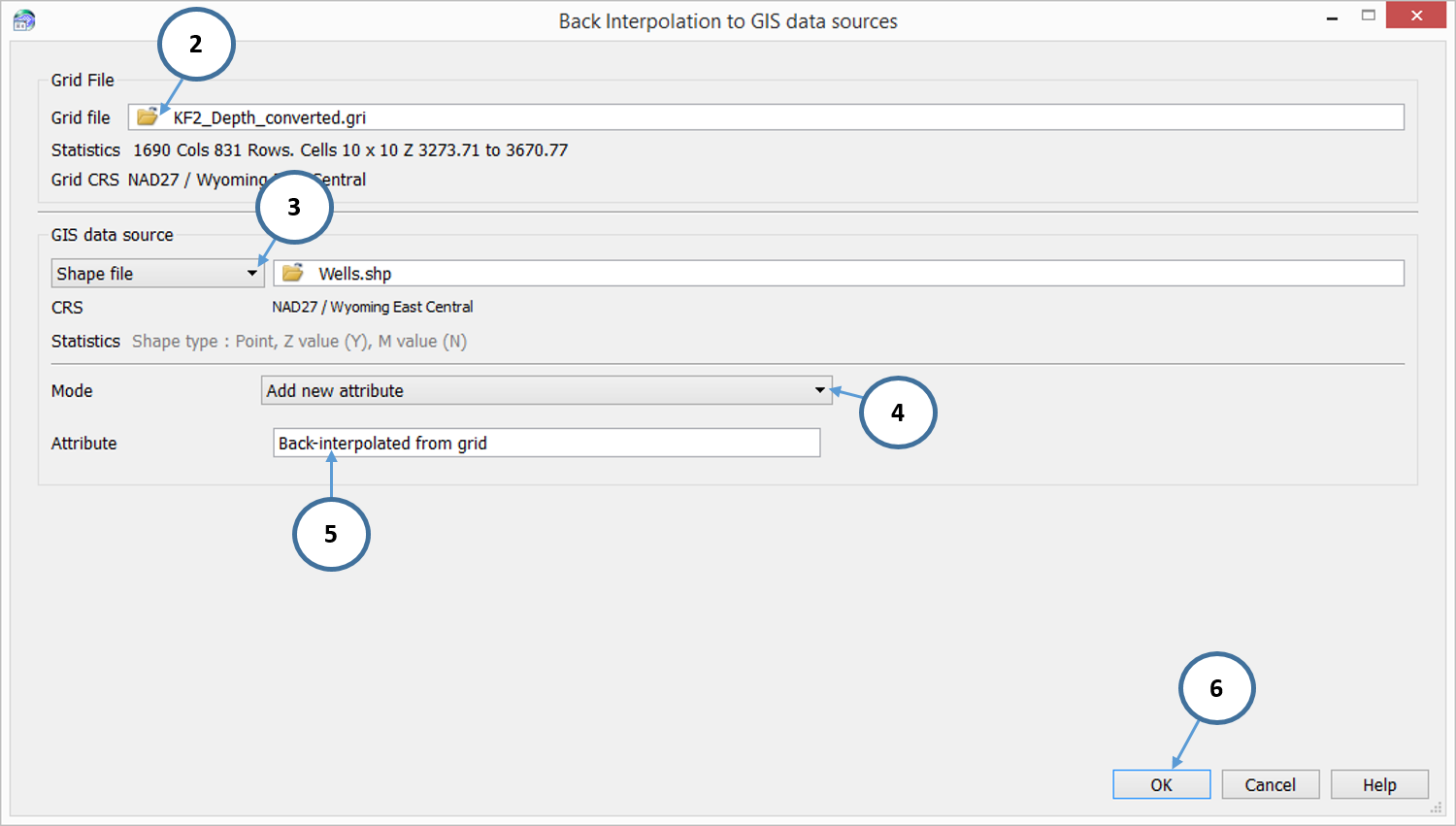
In Surface Modeling:
-
- Select Grid > Back Interpolate > To GIS
- Select the Petrosys Grid file
- Use the GIS data source drop down menu to select Shape File
- To create a new attribute, select the Mode drop down menu and select Add new attribute
- In the blank box, next to Attribute, type out the name of your new attribute
- Select OK
 樂威壯
樂威壯
ight=”397″ />
In Mapping:
- Select Edit > Spatial Editor
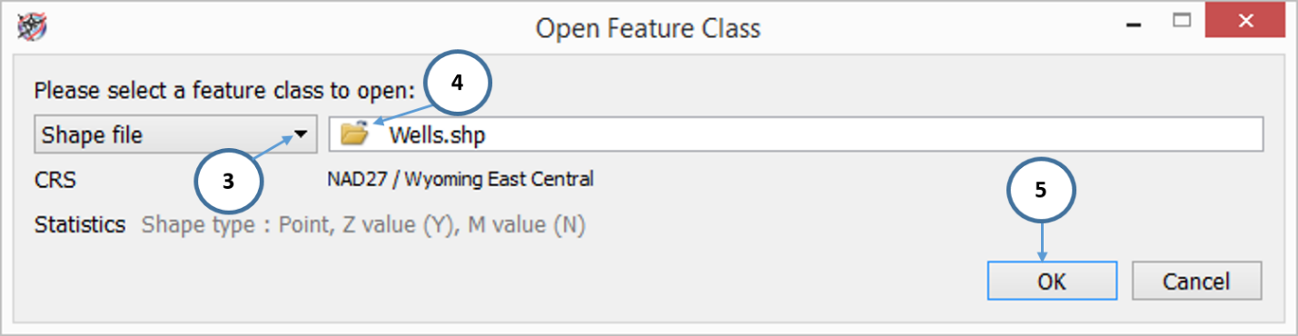
- In the Spatial Editor, select File > Open
- Use the drop down menu to select Shape file
- Select the yellow folder icon to navigate to the Shape file you wish to back interpolate to
- Select OK
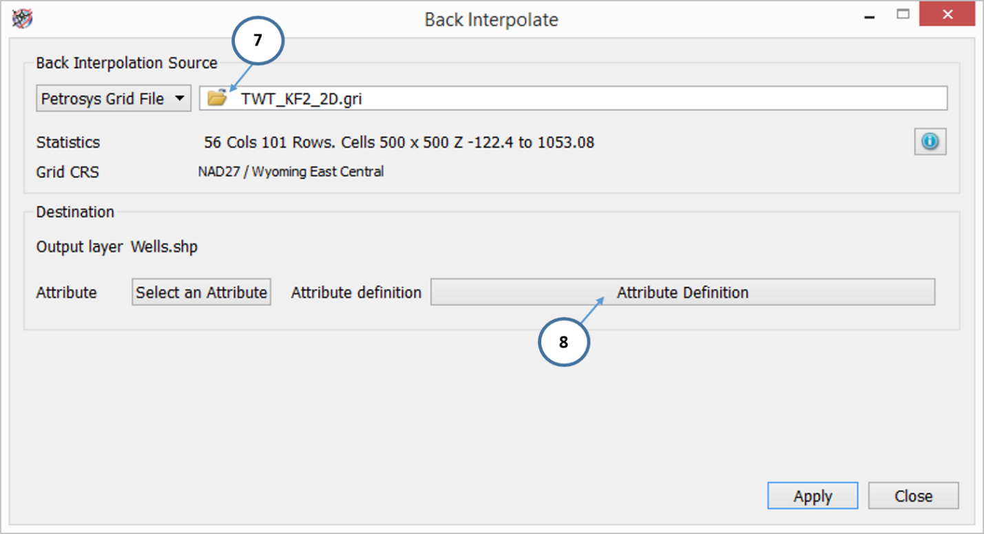
- Select Operations > Back Interpolate
- In the Back Interpolate window, select the Petrosys Grid File
- Select the Attribute Definition button
- In the Define Feature Class Attributes window, select the green plus icon
- Double click on the Name attribute and type out what you would like to call the new attribute
- Select the Type column for the new attribute and use the drop down menu to set the type to Decimal
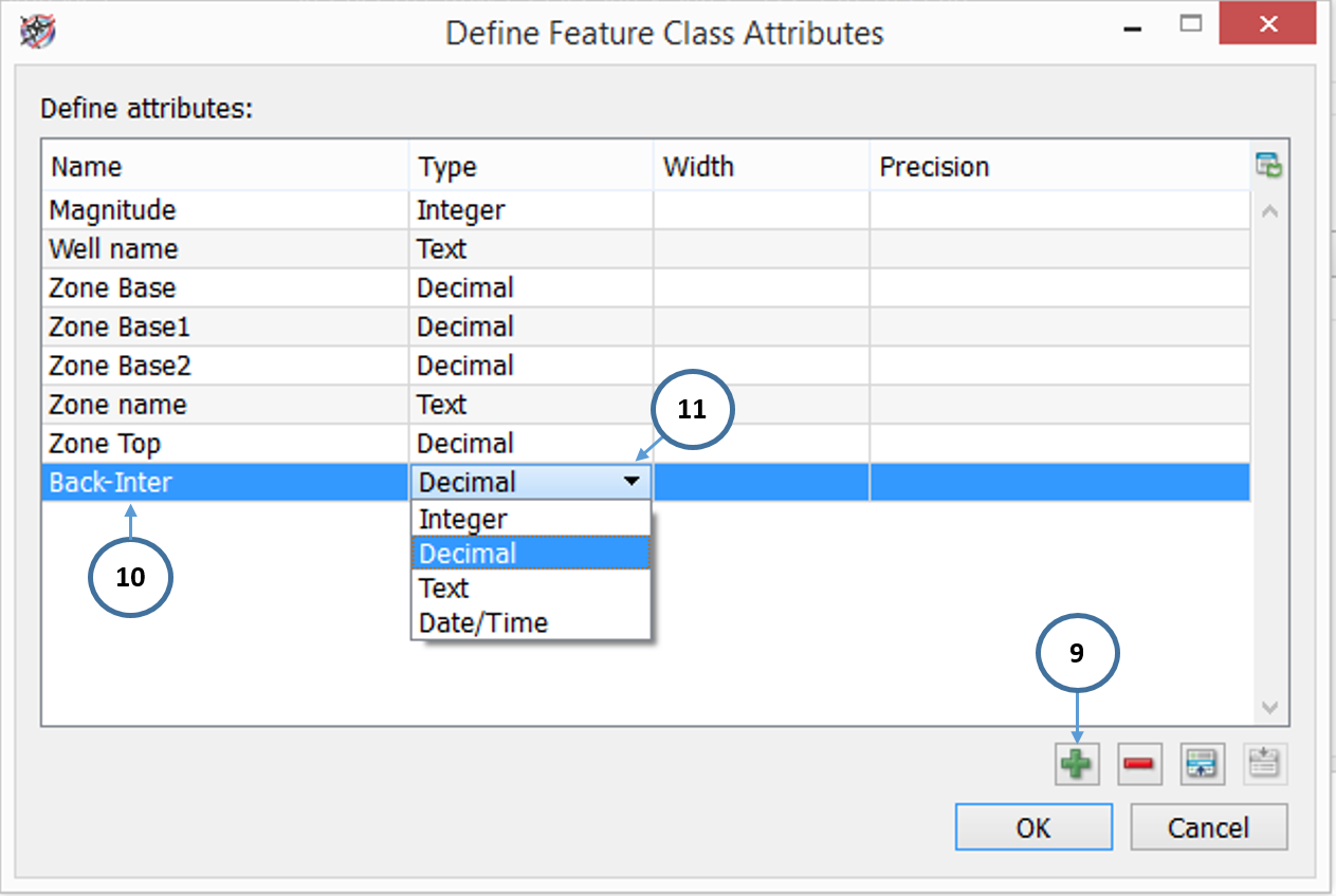
- OK the Define Feature Class Attributes window
- Select the Select and Attribute button, pick the new attribute and select OK
- Press Apply to back interpolate the grid data to the new Shape file attribute to all points