

MAPPING STANDARDS: A CORE COMPETENCY OF EVERY GEOSCIENTIST
Maps are a canvas used to express complex situations to help support difficult decisions.
In exploring the subsurface, maps serve a number of important purposes; recording and storing information; supporting the analysis of a range of subsurface data; and presenting and communicating information and understanding. Map creation should be a core competency of every geoscientist, used to express complex situations and help support difficult decisions.
Petrosys is a powerful subsurface mapping system that brings all your critical knowledge together on one mapping canvas. Our powerful, intuitive solution enables you to resolve complex challenges and to communicate geological information necessary for decision makers to take the right action.
Geoscientists, data managers and engineers at more than 300 sites worldwide use Petrosys as an essential tool for basin and field interpretation, to enhance enterprise data management, and to help make better decisions.
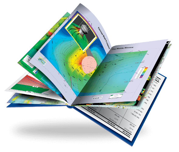
Mapping & Visualization
Petrosys mapping software gives you everything you need to display exploration, production and geographical data in the most compelling, relevant way. Add to that our 3D visualization tools and you’re able to combine map views with effective representations of surface models to facilitate, validate and present the interpretation and decision-making process.Read More
Direct Connectivity
Surface Modeling
Petrosys Services & Support
Our consultants can help E&P companies define and implement appropriate mapping standards to help geoscientists present a clear, consistent and concise suite of maps for a variety of purposes. Defined mapping standards enable geoscientists to spend more of their time focusing on the technical content.
Public training and customized on-site programs have mappers up to speed in no time and our famous global support team is on the spot, always.
Petrosys consolidates the knowledge of your entire team. It helps you discover opportunities which may only become obvious when information from multiple applications, disciplines and datasets are combined. To find out how Petrosys can be your greatest asset, please Contact Us!