

Petrosys mapping uses projects to collect control files, local data collections, surface interpretations and output files related to elements of an organisation’s activities. By default, these files are saved straight into the current project directory (otherwise known as “working directory”). Many users and sites like to set up subfolders under the working directory for grids, contours, cultural data and even further sublevels for different time and depth horizons, etc.
Often users will create these subfolders manually at the start of a project, however it is also possible to create them automatically by simply running a task file immediately after project creation.
To automatically setup a new folder structure:
- Start Surface Modeling
- Select Tools > Create Directory…
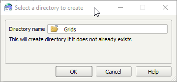
- Enter the name of the new subfolder.
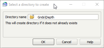
If you want to create another subfolder level within the new Grids directory, enter a pathname.
- Repeat this for as many directories as you require, then save the task.
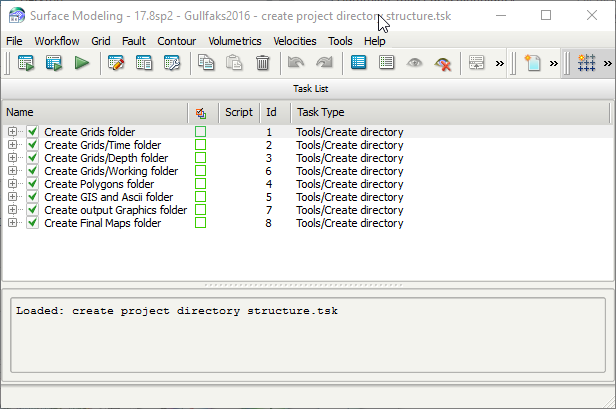
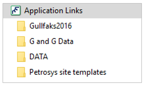
- Once you are happy with the task list, move the .tsk file to either the Petrosys local folder or a shared folder for site templates. Make sure a bookmark is available pointing to the folder to make access quick and easy – this way all users will be able to take advantage of the feature.
- When creating new Petrosys projects, run this task first to set up the folder structure.
- Geoscience and data management workflows stored in task files can be set up to automatically generate grids, or import grids and GIS data, to the new subfolders.
Contact support@petrosys.com.au if you need assistance in setting up new directories/folder structures.