

Petrosys Training Now Online!
Petrosys is pleased to announce that the first installment of its new Online Training program, the Introduction to Petrosys course, [...]

Santos Tour Down Under Kicks Off 2016
As the first stop on the world cycling calendar, the Santos Tour Down Under kicks off the cycling year in [...]

Newsletter Edition 32 Now Available
Welcome to Edition 32 of petrosysguru.com, the newsletter that contains the latest news and information from Petrosys. Read Newsletter [...]
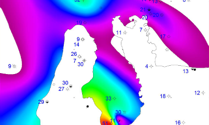
Displaying Data Using Bubble Maps
Bubble maps, whilst similar to point maps, not only display data at locations but they also exaggerate the size of [...]
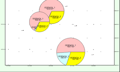
Unconventional Volumetric Workflow Using Petrosys
Coal Seam Gas (CSG) (also known as Coal Bed Methane (CBM)) is the gas derived from coal seams where the [...]
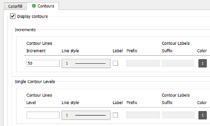
Dear Steve…
How do I create and/or display contours from a grid? Typically, the easiest way to create contours from a grid [...]
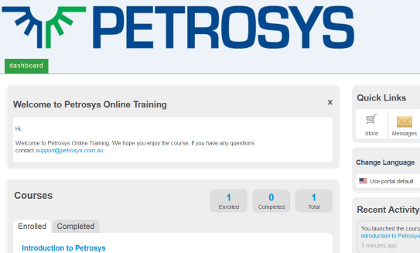
Online Training Course Nears Completion
In the June newsletter we introduced you to our new online training courses. Petrosys is pleased to announce that the [...]