

How can I check and edit my input data before gridding?
Create a GIP file! A GIP file is a Petrosys file, which can be created during gridding. The GIP file contains the raw input data points being used in the gridding process. Using an editing window you can delete “dodgy” points, add new control points or modify the values. This gives you an easy method to influence your output grid with your geological knowledge.
To check and edit your input data before gridding, go to the gridding task and set the Sampled Data File Action to Create and edit before gridding.
Now run the gridding task and a window will pop-up. There are three options available for viewing your data – plan (map), histogram and cumulative histogram.
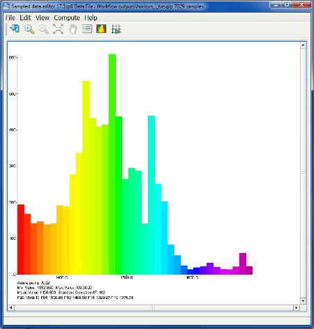
The plan and histogram views can be saved as raster images and shared with your colleagues or used in a presentation. In addition to viewing the data you can add, delete or modify data points in this window. You can save all points directly into an ASCII or Excel format, which can be used by other applications. And of course the GIP file, itself, can be reused just like any other set of points for another grid creation or for display in Mapping and now also in 3D Viewer (see the 3D Viewer Now Supports Point Data Such as Microseismic article).