Get Permit and Well Data at Your Fingertips

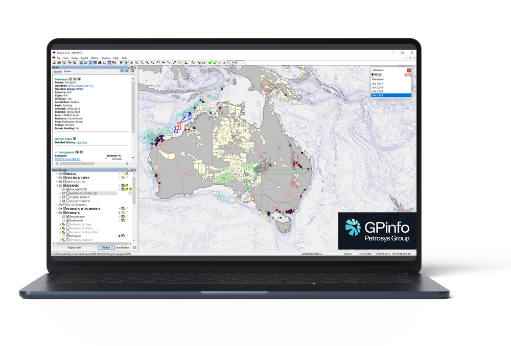
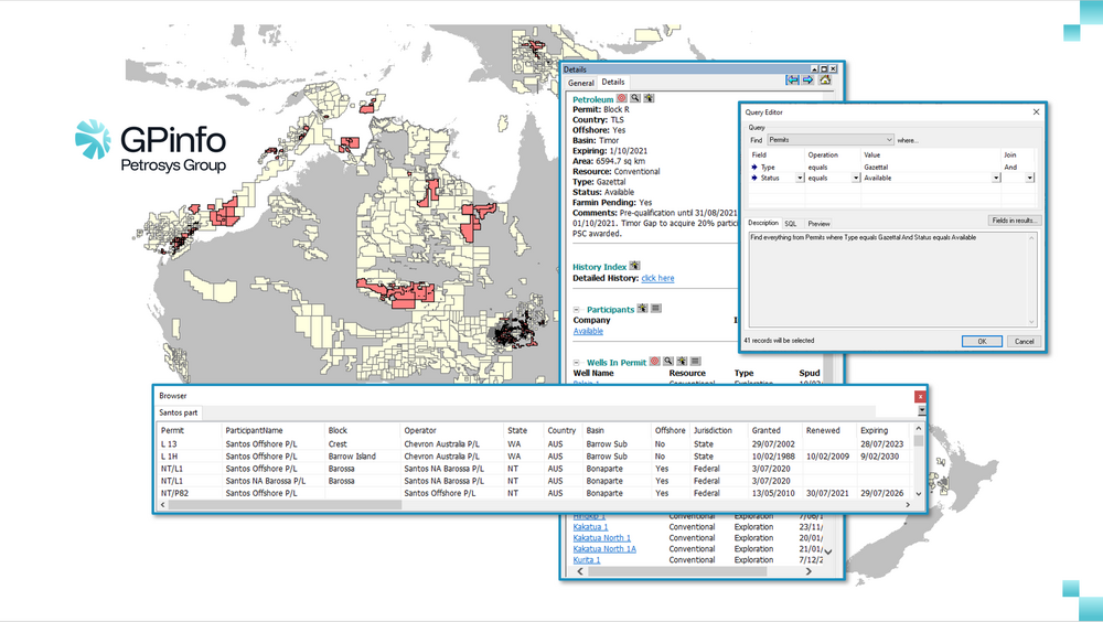
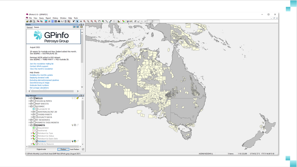
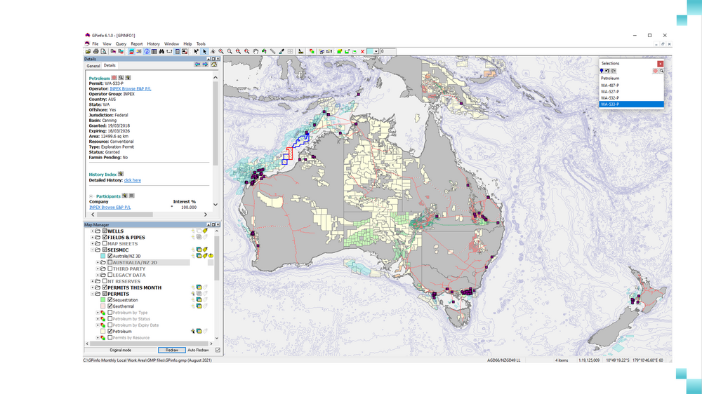
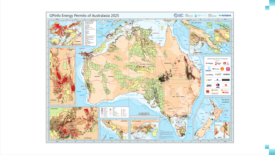
For more than 30 years, GPinfo has been the definitive Australasian energy exploration database, bringing together trusted information on permits, wells, and company information at your fingertips so you can make better, faster decisions. Our analysts collect data every day from operators, regulators and published sources, delivering monthly updates and our annual Energy Permits Map, helping you make evaluations and investment choices with confidence.

GPinfo Hero

"The permit maps are something we use all the time — they’re clear, well-annotated, and give immediate context when assessing opportunities or discussing decisions."

Order the Energy Permits Map

The GPinfo Energy Permits of Australasia Map is an attractive full-colour wall map produced annually with industry support, making it the most accurate and up-to-date map of its kind.Maps show permit polygons, well locations, field outlines, and pipeline routes. There are detailed insets of areas of exploration interest at larger scale including the Northwest Shelf and the Cooper, Surat, Otway, Gippsland, Taranaki, and Papuan Basins.

Maps are available through our online store as a laminated or unlaminated A0 wall map. Each purchase includes a complimentary A3 version.

Benefits of GPinfo

Gain the insight you need to make informed decisions about exploration, investment, and development. The world’s leading oil and gas, and emerging energy companies trust our up-to-date database to:
GPinfo Simplify

Simplify research.

Access detailed information on more than 3,500 companies, 3,000 permits, and more than 32,000 wells. Monitor available acreage, track activities of selected companies, and zoom in on areas of interest for more detailed information.
GPinfo Stay Current

Stay current.

Our analysts gather data daily and deliver monthly updates so you always have the most recent permit and well data.
GPinfo Track Companies

Track selected companies.

See where wells are located, who operates them, and if and when ownership has changed. Our History Dataset module provides a full summary of all changes made since 1991.
GPinfo Permits Map

Visualise and share data.

Export data and display it in a way that’s easy to understand using subsurface mapping software such as PRO or third-party mapping software including ArcGIS, MapInfo Pro, or ER Mapper. Attach high-resolution imagery to enhance on-screen displays.

What You Can Do With GPinfo

See, share and interact with your data easily and seamlessly to inform critical business decisions. With GPinfo, you can:

View and Query Data

Explore your geological data with a powerful, custom‑built GIS that includes:

  • Interactive mapping – View and manipulate well locations, permit polygons, and seismic line locations on an on‑screen map and query intuitively with a point and click interface.
  • A dynamic query builder – Create multiple, persistent queries and perform dynamic data selections to focus on the information that matters most.
  • Custom summaries – Generate permit ownership summaries, monitor available acreage, and track selected companies’ activities using built‑in reports and visualisations.

Import and Export Data

Integrate GPinfo data with your existing tools with these features:

  • Flexible data import – Bring your own geospatial and tabular data into GPinfo and display it alongside standard system layers. Supported formats include SHP, TAB, and MDB files.
  • Seamless data export – Export graphical data in real‑world coordinates to use it in PRO, MapInfo Pro, ArcGIS, and ER Mapper.
  • Enhance displays with imagery – Attach large‑scale, high‑resolution imagery (JP2 or ECW) for high-resolution, publication ready maps.

Get Expert Insights and Monthly Updates

Stay ahead of industry trends and regulatory changes with support from GPinfo, including:

  • Daily data gathering – Our analysts collect data every day from operators, regulators, and published media, ensuring GPinfo reflects the most current information.
  • Monthly e‑newsletters – Receive a monthly update summarising industry activity and highlighting changes in permits, wells, and company ownership.
  • Direct industry engagement – Our team maintains close contact with key stakeholders across Australia, New Zealand, and Papua New Guinea, and we regularly visit PNG to collect and verify data.

Who Uses GPinfo?

GPinfo is a valuable resource for exploration teams and executive teams alike. Here are a few examples:

  • Executive and finance teams – Evaluate investment opportunities and demonstrate return on investment using the most up‑to‑date permit and well data.

  • Geophysicists and geoscientists – Access seismic and well data when planning surveys or re‑evaluating prospects, and export data to your preferred mapping software.

  • Service companies and consultants – Monitor industry activities, analyse competitive landscapes, and identify potential clients.

  • Regulators and government agencies – Ensure compliance with exploration and production legislation and maintain accurate records for permits and wells.

"GPinfo has become our go-to source for well and field information, especially when we need answers quickly or are preparing for discussions and reporting."

Where GPinfo Fits Into Your Workflow

GPinfo supports early-stage evaluation and opportunity screening by providing trusted subsurface intelligence and historical context. It helps teams identify, compare, and prioritise assets before committing to acquisition, exploration, or development activities.
1

Opportunity Identification

Use GPinfo to assess basins, permits, and historical activity, helping teams quickly identify prospective opportunities and eliminate low-potential assets early.
2

Technical & Commercial Evaluation

Access curated subsurface information, production history, and regional insights to support informed technical assessments and commercial decision-making.
3

Acquisition & Portfolio Planning

Support asset acquisition, divestment, and portfolio strategy by providing reliable reference data and historical context that underpins confident investment decisions.

Our Customers

As the most trusted source of Australasian petroleum and energy exploration information, the world’s largest oil and gas companies trust and rely on GPinfo’s up-to-date database and energy permits map. Here are just a few of our customers.

bp logo
origin logo
Woodside logo
Shell logo
Vintage Energy
Mitsui
Bridgeport

Do More With Your Data

GPinfo sits at the front of the subsurface data lifecycle, helping teams identify, compare, and prioritise opportunities before committing to acquisition or development. It provides the historical and regional context needed to make confident early-stage technical and commercial decisions.

Once assets are acquired, other Petrosys Group solutions can support downstream workflows – from digitising and managing legacy data, to discovery, integration, mapping, and long-term data stewardship – ensuring continuity from opportunity identification through project execution.

Ask us about solutions that complement GPinfo across the wider subsurface data lifecycle.

FAQs

Frequently Asked Questions About GPinfo

How often is GPinfo updated?

Our energy information analysts gather data daily from operators, regulators, and published media. We provide monthly data updates via web download and accompany them with an e‑newsletter summarising industry activity.

What is the GPinfo History Dataset?

The History Dataset is an optional module that provides permit geometry and detailed ownership information from 1991 to the present. Subscribers can click on any permit to see a timeline of status changes, ownership changes, and partial relinquishments or extensions.

Can I import and export data from GPinfo?

Yes. You can import your own geospatial and tabular data in formats such as SHP, TAB, and MDB and display it alongside GPinfo’s standard layers. You can also export data in real‑world coordinates for use in PRO, ArcGIS, MapInfo Pro, or ER Mapper.

What mapping software does GPinfo support?

GPinfo integrates with a range of mapping packages. You can export data to PRO, ArcGIS, MapInfo Pro, and ER Mapper. You can import geospatial data from SHP, TAB, and MDB files. You can also attach high‑resolution imagery (JP2 or ECW) to enhance on‑screen displays.

How can GPinfo help me track company activities and available acreage?

With GPinfo you can monitor available acreage, track the activities of selected companies, and generate permit ownership summaries. The History Dataset shows changes in ownership over time, and monthly updates ensure you always have current information to support investment decisions.

Talk With Us

Have questions or suggestions? We’re always looking for feedback from our subscribers to improve our database. Feel free to contact us anytime.