See Opportunities Clearly With Claritas

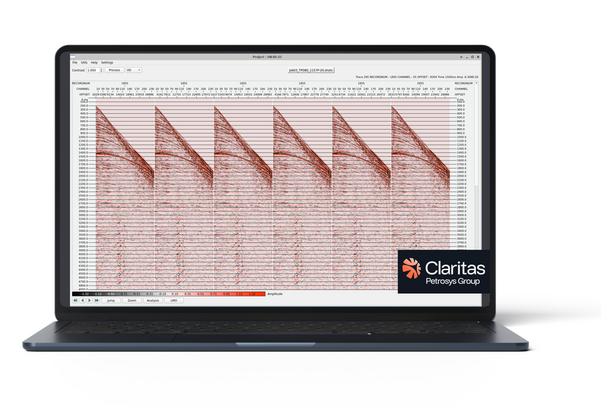
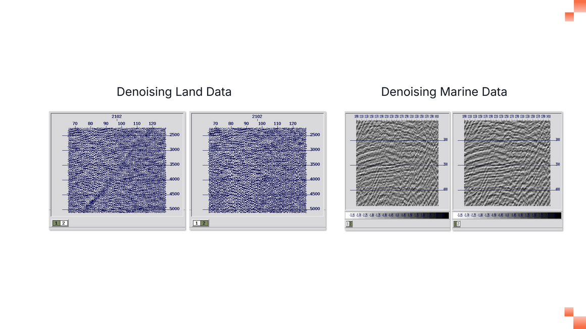
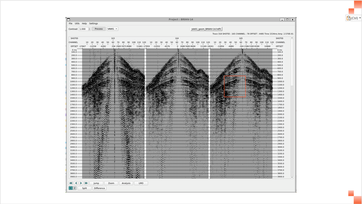
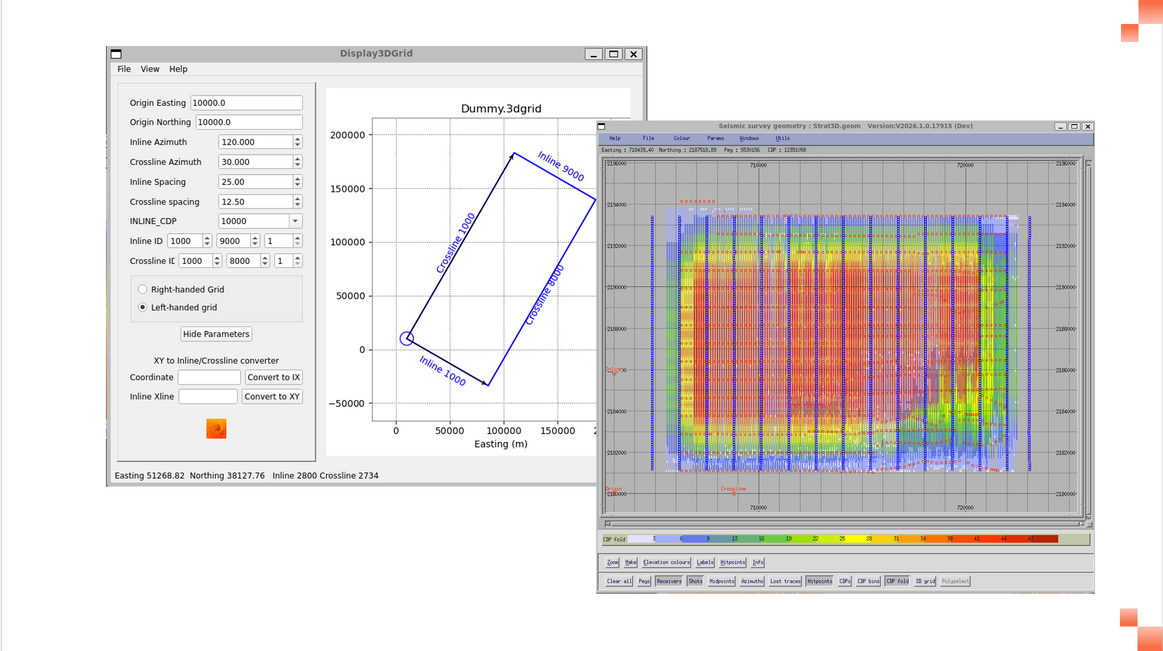
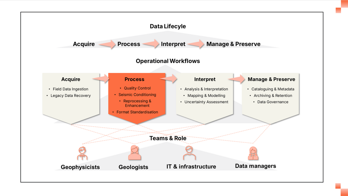
Every seismic survey captures enormous volumes of data, but until that data is cleaned and refined, its value remains hidden.

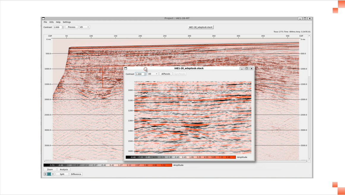
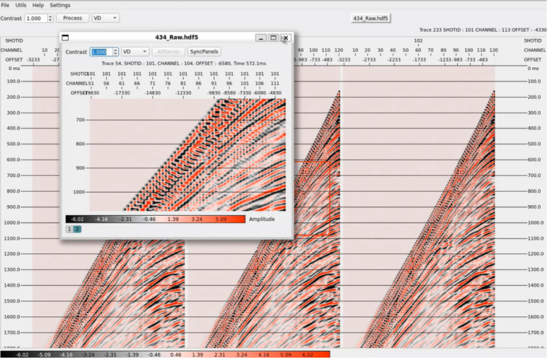
Claritas seismic data processing software gives geophysicists, data managers, and energy innovators the tools they need to clean, analyse, and image their seismic data quickly and with confidence. With more reliable insights, your team can make better decisions about where to drill, install turbines, or assess geothermal prospects.

Claritas Hero

"Being able to see exactly what’s been done to the data at each step makes it easier to trust the final results."

What Can You Do With Claritas?

Claritas turns raw seismic data into geological insight. From field QC to final imaging, Claritas helps you produce reliable seismic results faster and with greater clarity.
Claritas Denoising

Reveal More Detail In Complex Settings

Capture subtle variations in near-surface areas, and complex environments to improve depth positioning and reveal shallow hazards. Claritas’ full waveform inversion operates at a higher frequency, providing accurate models even in challenging settings.
Claritas Geometry

Control Data Quality From the Start

Ensure your data is reliable from the moment it’s recorded, enabling better modeling and smoother processing. Claritas allows you to analyse first breaks of surface waves on site so you can detect problems like bad channels or irregular geometry and correct them sooner.
Claritas build clear models

Build Clearer Models

Gather clear 2D and 3D images with advanced broadband de-ghosting that corrects low- and high-frequency “ghost” notches from cable tow depth, producing more accurate subsurface models.
Claritas Seismic Viewer

Work Faster

Reduce seismic data processing time and project costs. With Claritas, you can build and refine velocity models quickly with high-performance algorithms and a modern Python-based seismic viewer.
Claritas Integrate - Collaborate

Integrate and Collaborate

Move from seismic data acquisition to interpretation faster and with greater confidence. Claritas supports the seismic processing stage, preparing raw and legacy data for interpretation through quality control, reprocessing, and standardisation. Clean, well-defined outputs enable smooth hand-offs into interpretation and long-term data management workflows, supporting collaboration between geophysicists, geologists, data managers, and IT teams across projects.

Claritas Capabilities That Bring Seismic Data to Life

When you start with cleaner data and better images, you can more effectively collaborate for more profitable outcomes in less time.

Real‑Time Data Quality Checks

Claritas helps your team verify and improve data quality from the moment it is recorded.

  • Monitor data quality during acquisition, detect noise or geometry problems and fix them before leaving the field.
  • Easily review contractor outputs, highlight issues and recommend cost‑effective solutions with software that runs on laptops.
  • Automate data quality checks with tools that remove residual static and reflections, and correct them to ensure reliable results.

Support for Land & Marine Surveys

Handle land and marine surveys from start to finish with comprehensive software that supports every stage of your land and marine projects.

  • Build accurate 2D and 3D models for land models with robust first‑break picking, refraction statics, and residual statics corrections that help you deliver high‑quality results in less time.
  • Produce clear, reliable images from marine surveys with features that automatically remove unwanted surface‑related reverberations and ghost artefacts, migrate data before stacking for more accurate positioning, and fill in missing traces to ensure uniform coverage.
  • Scale workflows easily, helping teams tackle large surveys and stay on schedule

High‑Performance Imaging Algorithms

Advanced modules deliver clearer images and better models, giving you greater confidence in your decision-making.

  • Remove low- and high-frequency “ghost” notches with the Octave module.
  • Image complex structures with sophisticated 3D pre‑stack time migration and modules with improved geometry handling for ultra‑high‑resolution.
  • Fill large data gaps using 5D regularisation and SRME3D models.

Flexible Deployment & Data Management

  • Run Claritas on Windows via Windows Subsystem for Linux (WSL).
  • Compare multiple datasets for more detailed interpretation with an interactive Python-based seismic viewer
  • Merge datasets and clean up hidden files

Ongoing Training & Support

Help your team succeed with comprehensive training and a responsive team of experts with deep knowledge of the field.

  • Teach seismic processing to students with step-by-step tutorials and a “course in a box”.
  • Benefit from the latest workflows and enhancements with regular updates

Who Uses Claritas?

Claritas is designed for the people who make seismic data meaningful, including:

  • Geophysicists and processing consultants use it to build and test processing flows, pick first breaks, perform statics and velocity analysis, de-ghost and deduplicate data, and QC results.

  • Energy and environmental engineers use it to analyse near‑surface effects, estimate site statics, and evaluate shallow hazards.

  • Universities use Claritas to teach seismic processing and support research across disciplines within a ready‑made learning environment.

  • Data managers and IT teams use it to manage diverse data formats, convert velocity files, and deploy the software across Linux or Windows/WSL environments.

"We switched to Claritas because it’s actively supported and continually improving, which made a noticeable difference for our team."

Where Claritas Fits Into Your Workflow

Claritas supports seismic teams by processing and imaging seismic data to reveal reliable subsurface insights.
1

Data Preparation

Your team receives seismic data from new surveys or legacy datasets. You need to clean and prepare the data so it is suitable for reliable processing and imaging.
2

Seismic Processing

Apply processing workflows to analyse and enhance seismic data, reducing noise and improving signal quality to support accurate interpretation.
3

Imaging

Generate clear seismic images that reveal subsurface structure and support confident decisions about drilling, offshore wind, or geothermal prospects.

Claritas Success Stories

Case Study

Land Acquisition Contractor

Case Study
Resource 2

European University

Case Study

Marine Geophysical Survey Contractor

FAQs

Frequently Asked Questions About Claritas

Can you run Claritas on a Windows PC using WSL?

Yes. ​​While Claritas is built for Linux, Windows users can run it seamlessly using Windows Subsystem for Linux (WSL). You can install WSL either with a single command (wsl –install) from PowerShell or go to the Microsoft Store and choose a supported Linux distribution such as Ubuntu 22.04 or 24.04, then install the Claritas tarball within that environment. This approach means you get the performance and flexibility of Linux without leaving your Windows desktop.

Learn more here.

Can we import velocity files to Claritas?

Absolutely. If your velocity field is supplied in SegY format it can be read directly by Claritas modules such as NMO and our imaging tools. For legacy ASCII formats (ESSOV2/UKOOA/SHELL, Western and others), the ISOVELS application converts them to Claritas’ .nmo format or back to SegY. ISOVELS visualises and quality‑controls velocity fields, supports custom filters for non‑standard formats and can export velocity fields to SEGY or other interchange formats.

Learn more here. 

How will Claritas help my team collaborate?

Claritas supports collaboration on multiple fronts. Its lightweight footprint allows users to run the software on laptops, while parallel processing options let teams deploy flows on clusters for large projects. Integrated QC and visualisation tools make it easy for geophysicists, geologists and engineers to review results together. Tutorials and documentation provide a common language for teams with varying experience levels. The ability to export data in standard formats that is compatible with  Petrosys Group data management solutions ensures that everyone works from the same, trusted datasets.

How does Claritas improve modeling accuracy?

Claritas improves modelling accuracy through advanced algorithms and smarter workflows. Surface‑consistent deconvolution modules estimate shot, receiver, mid‑point, offset, and azimuth corrections, enhancing spectral accuracy. The WANGSHIFT module optimises multiple models to align them with recorded data. Improved geometry handling ensures that common depth points stay aligned in UHR. Together, these tools reduce noise, correct for complex overburden and lead to more reliable velocity models and images.

What data formats does Claritas support?

Claritas reads standard SegY seismic and velocity files directly through its processing modules.The ISOVELS application converts ASCII interchange formats (ESSOV2, UKOOA, SHELL, Western and Promax) to Claritas’ .nmo format or SegY and supports custom filter definitions for non‑standard files. Claritas also supports 2D and 3D processing for land and marine surveys, with tools for N‑dimensional interpolation, regularisation and migration.

Does Claritas support both 2D and 3D processing?

Yes. Claritas provides comprehensive 2D and 3D land and marine processing capabilities, including automated first‑break picking, refraction and residual statics, de-ghosting, surface‑related multiple elimination, PreSTM/PreSDM and 5D regularisation. STITCH and N‑dimensional interpolation modules make it easy to fill gaps and regularise sparse data.

What sets Claritas apart from other seismic processing software?

Claritas combines high‑performance algorithms with transparent workflows and responsive support. The stand‑alone iMage platform delivers superior results faster, while modules like Octave and STITCH tackle challenges that many vendors leave unsolved. The software runs on laptops, clusters, and Windows via WSL, making it accessible to teams of all sizes. Its extensive tutorials and academic adoption ensure that users understand the underlying physics. As a product of Petrosys, it has the backing of a trusted name in geological data management for more than 40 years.

See Claritas in Action

Request a demo to discover how Claritas can help you build accurate seismic models, reduce uncertainty and share insights across your organization.