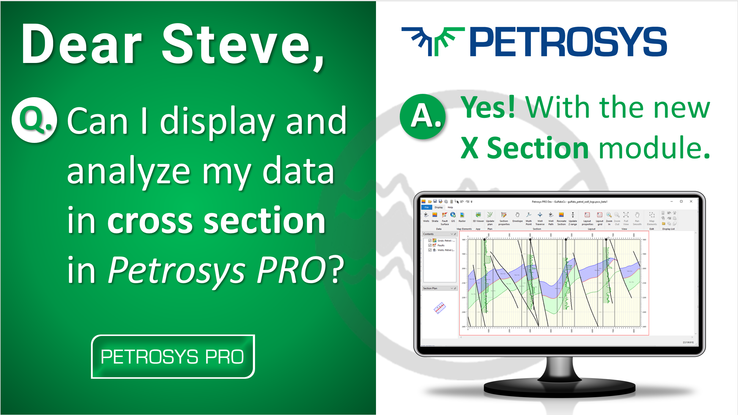
mapping

February 2023

November 2021

December 2020

Printed Maps vs Digital: Do we still use paper maps?

The way in which we view and interact with maps of all types and across all sectors of life and industry has changed significantly too. As the self-proclaimed ‘Mapping Gurus’, here at Petrosys, we have a clear interest in how our customers work with maps, which has recently raised the question – why do we need printed maps when digital maps are so readily available?

September 2020

Using Colour to Communicate

Improve your mapping standards by taking advantage of the latest scientific colour gradients. We have added a number of perceptually uniform and ordered gradients to new release Petrosys PRO 2020.1, created by Fabio Crameri

July 2020

December 2018

August 2018

Go to Top