

Introduction
At the recent EAGE in Copenhagen, I had a quick chat with some national regulators. I wanted to find out if a concerted effort to improve subsurface mapping standards is something which would help them when promoting areas of prospectivity and when awarding new exploration and production licenses. To my surprise, as a subsurface mapping advocate, it’s not something the regulators are particularly interested in standardising.
Aside from some basic mapping guidelines companies are free to submit maps with varying styles and colour schemes in my opinion creating a lot of extra work for the regulators to be able to decipher map content, see figure 1. However, in these data-rich times, there are higher priorities facing the regulators which they must attend to in order to continue providing the excellent service they do. It therefore got me wondering: Is there value in a company standardising its subsurface mapping practices for license round applications or would it be more efficient to let individuals choose their own styles?
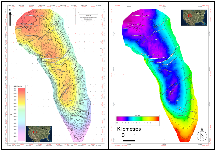
Figure 1: Two maps created using Petrosys PRO but without using standard styling.
What do we mean by subsurface mapping standards?
It would make sense to first quickly define what subsurface mapping standards are. You may disagree and please comment below if you do, but to me subsurface mapping standards involve 2 components:
- Cartographic style choices
- Gridding and Contouring considerations
The 1st part is easy and entirely subjective. You look at the regulators basic requirements, e.g. maps must have north arrow, scale, legend etc., and you choose which styles/colours each map will have and where these elements will be positioned on each map. You then make sure all your maps adhere to this standard.
The 2nd part requires more thought and is where geoscientists really make their money. It’s about making all geoscientists aware of which software, algorithms and editing methods are available to them and when they are appropriate to use. For example, when is it appropriate to manually edit how contours interact with a fault and when is this just ‘fudging’….
No matter how a company approaches this, the idea is to make subsurface map creation more efficient, consistent and of a higher quality.
Benefits of Mapping Standards
Even though they may not be a ‘regulatory requirement’, here are some good reasons why mapping standards are economically beneficial to a company. Do you have any other reasons you would add to this list?
1. Internal discussions/peer reviews
No map just gets created and put into an important license application document. It gets scrutinised internally,樂威壯
ripped apart even, until you and your peers are happy that it is the best geological representation of your area of interest, based on the available data. That means in the run up to a license application round, you’re going to be seeing a lot of maps.
By implementing mapping standards for licensing rounds, internally it allows you and your colleagues to compare and evaluate your maps more efficiently. Where is the North Arrow? Where is the scale? Is the red colour high or low? With clear mapping standards all of this is taken care of and you can focus on what you do best … geologising!
2. Time saving
Most mapping applications these day will have some ability to standardise styles and map elements across different maps. We invested heavily in this here at Petrosys recently with the implementation of ‘map templates’.
As most of you will have noticed, the Petrosys PRO concept of ‘map templates’ allows standardised styles to be applied to any map at any extent, scale, page size etc. In fact, in our current development version, we’ve extended this concept further to include ‘base map’ templates where the display and style of typical GIS, or any other, layers can be standardised (keep a look out this will be released for you soon 😊). Any form of standardisation at a high level means the technical users don’t have to spend time ‘designing maps’. Giving geoscientists a standardised canvas or base map to display their subsurface data onto is a huge time saver … it just makes so much sense for efficiency
3. First impressions
I recently started an MBA and as its been about 10 years since my last exam, I suddenly remembered one of my biggest educational hinderances: My handwriting! It’s a bit of a disgrace to be honest and can be hard to read even at the best of times. My concern with this has always been that it leaves a bad first impression. In fact, it seems that I was right to be worried. Published articles have shown that there is a link between poor handwriting and bad exam results and this is partly due to human bias where an examiner sub-consciously devalues your work, prior to looking at the technical content, simply because it looks poor. I don’t have any evidence to suggest regulators do the same but personally I believe a well thought-out, high quality map gives a first impression of accuracy and technical ability … i.e. it makes you look smarter.
For example, have a look at these 2, technically identical, maps and think about which one gives the best first impression.
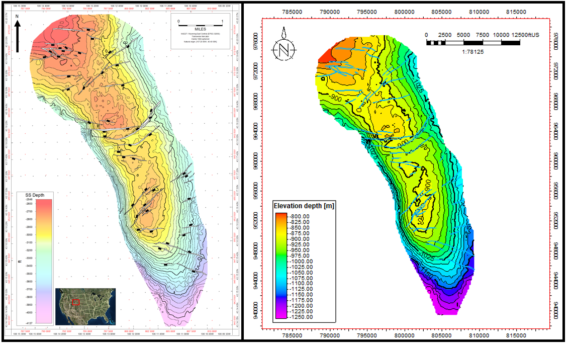
Figure 2: The map on the left has been created using Petrosys PRO with time spent improving the styling. The map on the right has been created using Petrel and accepting the default styles.
4. Technical accuracy
I’m amazed at how many published maps don’t take into account basic contouring considerations. Things like bullseyes and even worse things like contours running straight through faults seem to be commonplace in our industry. The effects on volumetrics and the carryover effect through to dynamic simulations is troubling. At this early stage of a long and crucial workflow, geoscientists (especially the younger ones who have never done this sort of work on paper) need to be given some key guidelines about what to look for when contouring using a computer, e.g. artefacts and how contours should interact with faults in a given structural environment.
Conclusion
There are clearly key reasons why it makes economic sense for companies to adhere to a set of subsurface mapping standards, even if they are not a regulatory requirement. From basics such as time saving, through to a better understanding of complex geological scenarios, it’s an area of geoscience in our modern world of high processing power and glamorous modelling software that is in my opinion being seriously overlooked.