

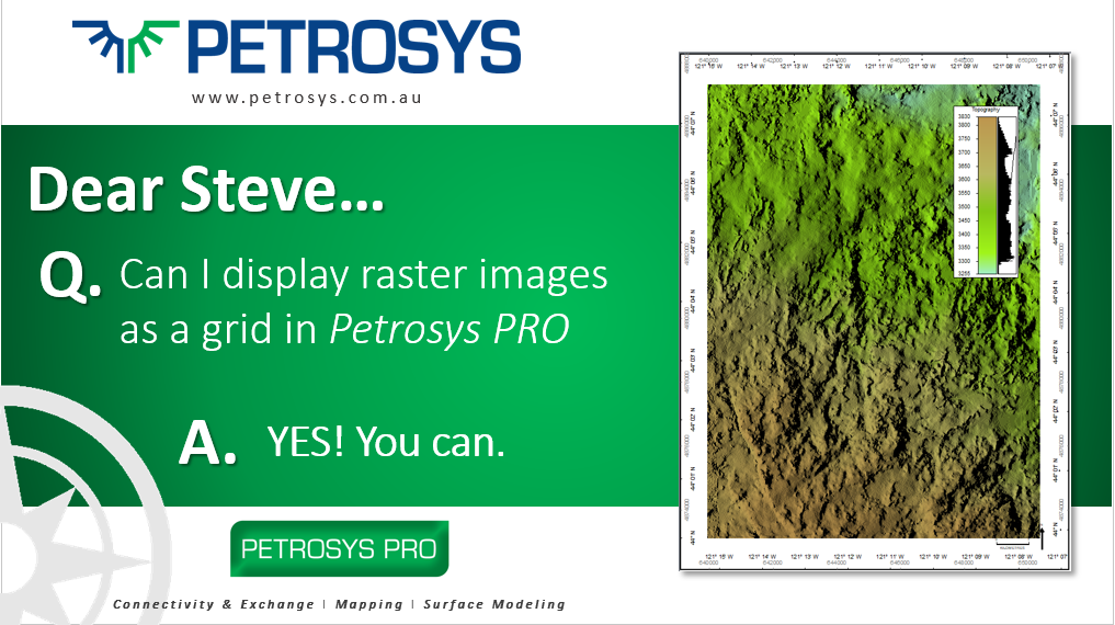
Q. Dear Steve… Can I display raster images as a grid in Petrosys PRO?
A. Yes, now you can!
With the release of Petrosys PRO 2020.1, users are now able to display raster imagery with XYZ data as grids in Mapping and, in general, use across the software as part of any workflow. The new functionality will allow users to quickly add and use these types of georeferenced images into their maps and workflows without having to import them into one of the traditional grid formats.
To be able to directly display raster images as grids, two conditions need to be met:
- Images need to be georeferenced
- A ‘digital value’ needs to be assigned to each pixel in the image. This is the value that would be used as ‘z’ when displayed as a grid.
For users to take advantage of this functionality in Petrosys PRO Mapping, all they need to do is to follow the same workflow to display any grid in PRO:
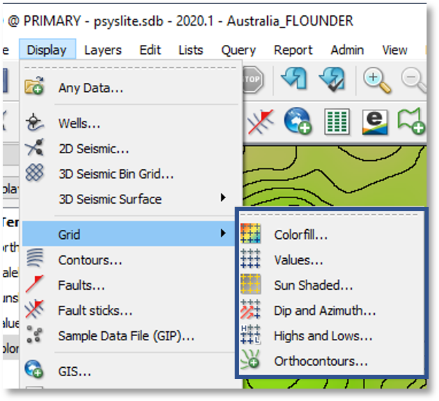
- In Mapping, go to Display > Grid… or click the relevant icon.

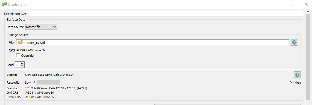
- Set the data source to ‘Raster file’.
- Point to the raster image.
- If needed, override the CRS. This option is available as not all raster formats store this info.
- Then, tread as any other grid and set the parameters accordingly. Note you will be able to generate contours ‘on the fly’ from the Contours
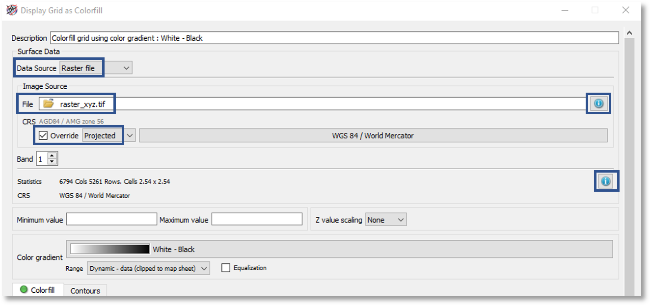
To query the raster metadata, click on the ‘information’ icon on the right side of the file box ![]()
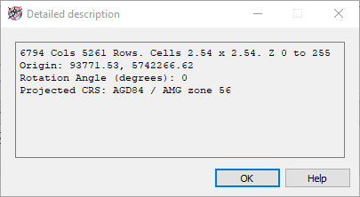
A panel like the below one will be presented. Checking and understanding the raster metadata is important as users need to be aware of which ‘band’ contains the relevant info to be displayed.
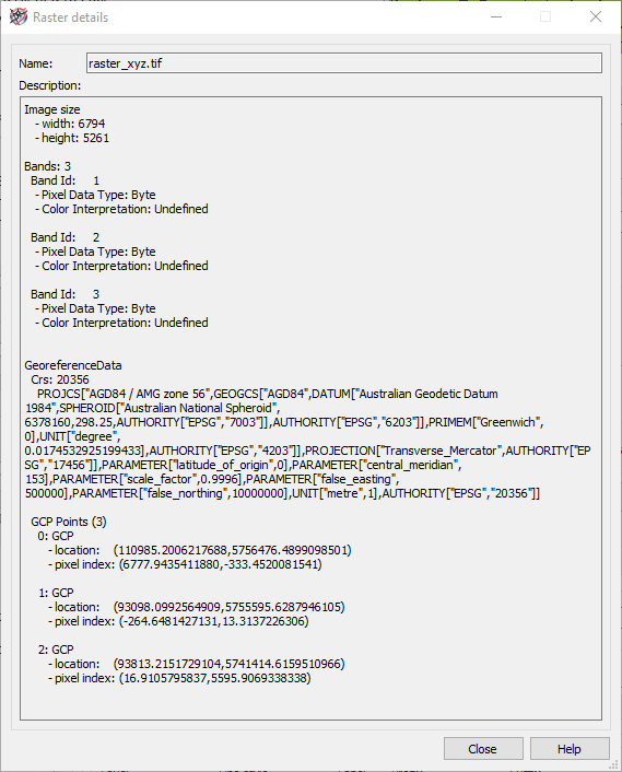
To query detailed grid statistics, click on the ‘information’ icon on the right side of the statistics section. A panel like the below one will be displayed.
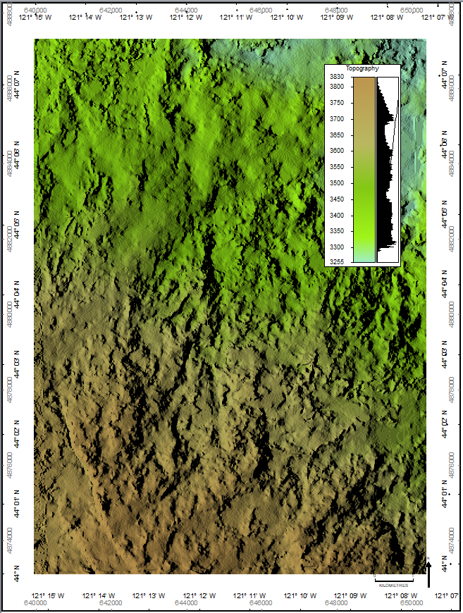
In addition, rasters can also be displayed as grids using any of the display options you would have for any grid: colorfill, values, sun shaded, highs and lows, and even orthocontours.
The use of raster imagery as grids is not only restricted to Mapping but can be used across the software both in Surface Modeling and the 3D Viewer.
In the below screenshots from Surface Modeling, it can be seen that in any workflow where there is the ability to select grids in various formats, the ‘raster file’ has now been added as one of the input options. The ‘Surface Modeling’ application can also now import raster files with non-square cells.
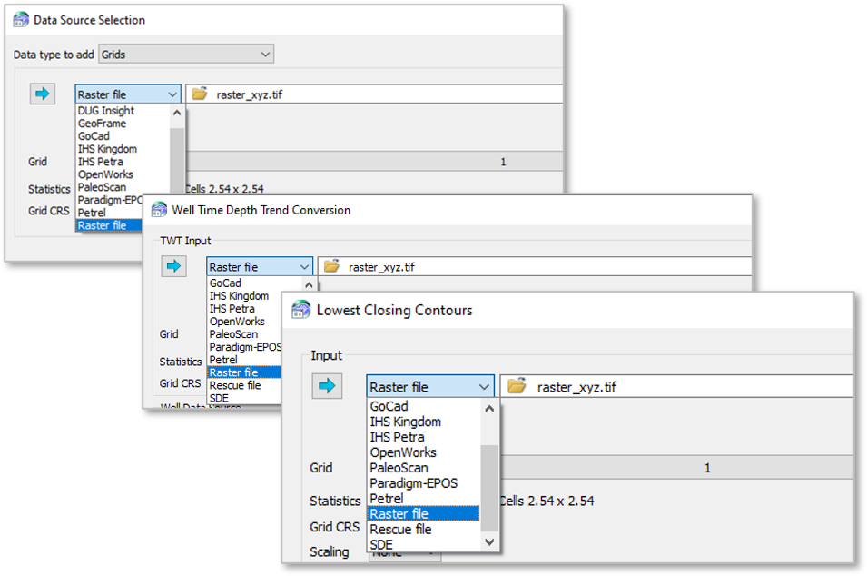
And same goes for the 3D Viewer…
File types supported include DEM, GeoTiff, ECW, Arc BinaryGrid, ERDAS Imagine and BIL files.
Read about more new functionality in the release notes or users can find numerous workflows in pdf or short video format are available in the Client Portal.
Get in touch
If you would like to know more about Petrosys PRO contact our team of mapping gurus.