The problem: Defining the spatial outline of an oil-water contact that is based on both a structure contour and a pair of bounding faults.
The solution: Using the Spatial Editor tools to create a polygon from existing contours and faults.
How to create a polygon built of handpicked lines, faults and contour segments:
- In Mapping, select /Edit/Spatial Editor…
- Use the open icon
 to load contour, fault and polygon data into the Editor.
 - Click the new icon
 to start defining a new layer. Set the Layer Type to Full Definition. Under the Details heading, set the drop-down menu to Petrosys polygon file and use the file selector to specify the name and location for the file used to store the outline of the contact. Click the OK button to create the layer.
 - Select the Interactive Editing tool using the pencil icon
 . Set the tool parameters to match the image below:
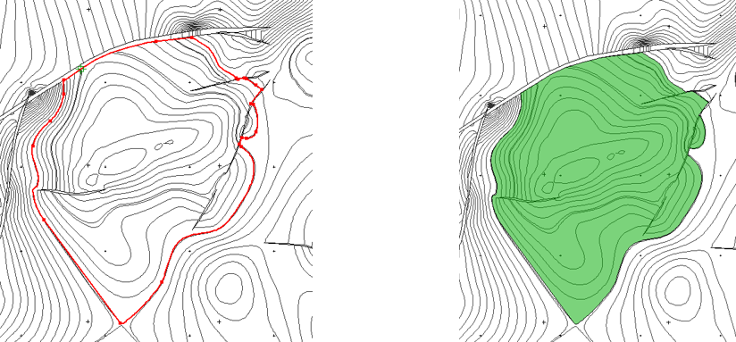
- Trace the outline of the contact by left clicking points along any existing contour, fault or polygon. Valid points are determined by two visual cues: the mouse cursor changing from an arrow to a cross-hair, and a red line indicating the line segment traced between two points.
- Left click the first defined point to complete the contact outline. The outline may also be completed by double clicking.