Q. Is there a way to quickly calculate the centroid and area of polygons in Petrosys PRO?
A. Yes, this can now be done easily in Petrosys!
In our latest release, Petrosys PRO 2018.3, we have added the ability to calculate and create a report of the centroids and areas of polygons in Mapping.
To do this, once you have displayed the relevant layer in Mapping, all you need to do is to select a polygon, right-click on it and select ‘Report Centroid & Area…’
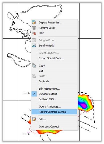
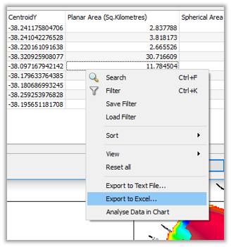
As a result of this action, you’ll get a list with areas and centroids of every polygon within the extent of your map. Note you can change the area units from the relevant dropdown option and the CRS from where the calculation of the centroid is based on.

Once in the list, if you right-click on it, you could export this report into an excel/text file.
Finally, you could display this excel or text file on your map as well by using DisplayGIS… or by simply ‘dragging and dropping’ the relevant file from Windows Explorer into Mapping. Petrosys will use CentroidX and CentroidY columns to automatically post these points in their right locations.
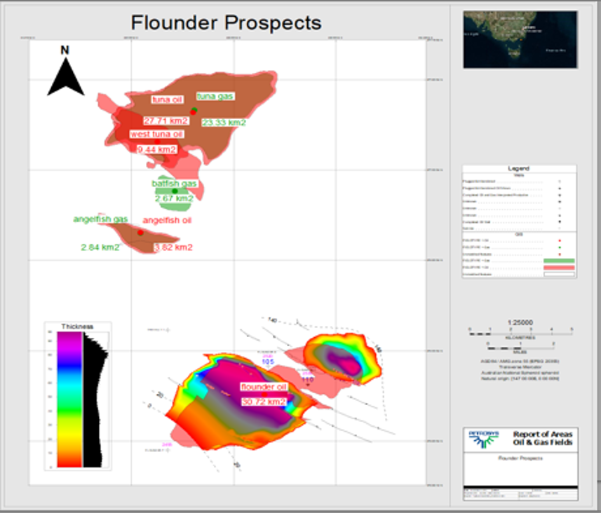
And with the use of the styling options for annotation and shape, i.e. thematic mapping, you could even convey additional information and make your map more relevant.